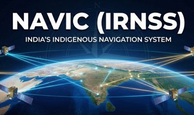
NAVIC (IRNSS): India's Indigenous Navigation System
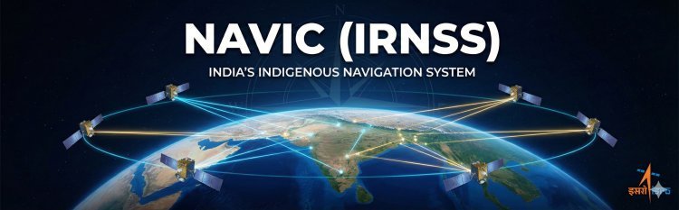
Navigation with Indian Constellation (NAVIC), also known as the Indian Regional Navigation Satellite System (IRNSS), is an autonomous regional satellite navigation system developed by the Indian Space Research Organisation (ISRO). It is designed to provide accurate real-time positioning and timing services over India and a region extending 1,500 kilometers around its borders.
Why did India Need Its Own Navigation System?
During the Kargil War in 1999, the Indian military faced a critical situation when access to the US-controlled Global Positioning System (GPS) was denied in the conflict zone. This event underscored the strategic vulnerability of relying solely on foreign navigation systems for national security and defense. To ensure self-reliance and sovereignty in satellite-based navigation, the Indian government sanctioned the IRNSS project.
Beyond defense, an indigenous system offers several advantages:
-
Assured Service: Guaranteed access to navigation signals for civilian and military users, even in times of international crisis.
-
Improved Accuracy: Optimized for the Indian subcontinent, it provides better accuracy in the region compared to global systems.
-
Strategic Independence: Reduces dependence on foreign nations for critical navigation and timing data.
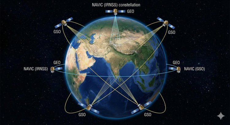
The NAVIC Constellation: A Unique Design
Unlike global systems like GPS or Galileo which use dozens of satellites in medium earth orbits, NAVIC is a regional system with a unique constellation of just seven satellites. This configuration is specifically designed to provide continuous coverage over the Indian region.
-
3 Satellites in Geostationary Orbit (GEO): These satellites appear fixed in the sky relative to an observer on Earth, located at 32.5°E, 83°E, and 129.5°E longitudes.
-
4 Satellites in Geosynchronous Orbit (GSO): These satellites are in inclined orbits that trace a figure-eight pattern over the Earth's surface. They are positioned in two planes with an inclination of 29° to the equator.
The image below illustrates this unique constellation, showing how the satellites are positioned to focus their service over India.
How Does NAVIC Work?
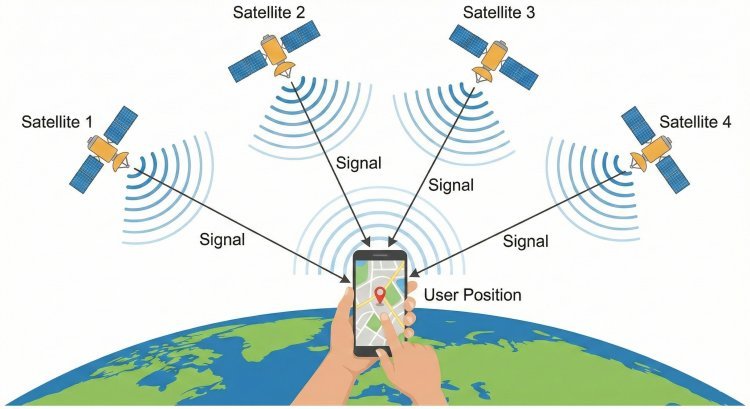
NAVIC, like other GNSS systems, works on a principle called trilateration. The process involves the following steps:
-
Satellite Signals: Each NAVIC satellite is equipped with highly accurate atomic clocks. They continuously transmit signals containing their precise position and the exact time the signal was sent.
-
Signal Reception: A user's receiver (like a smartphone or a navigation device) receives these signals from at least four satellites simultaneously.
-
Calculating Distance: The receiver calculates the time it took for each signal to travel from the satellite to the receiver. Knowing the speed of light (at which radio signals travel), it can determine the distance (or "pseudorange") to each satellite.
-
Determining Position: By knowing the distance to at least four satellites and their precise locations, the receiver can mathematically determine its own three-dimensional position (latitude, longitude, and altitude) on Earth.
The following diagram provides a simplified visual explanation of how a user's position is calculated using signals from multiple NAVIC satellites.
Key Components of the NAVIC System
The system consists of three main segments:
-
Space Segment: The constellation of 7 satellites in their GEO and GSO orbits.
-
Ground Segment: A network of ground stations responsible for controlling the satellites, monitoring their health, and uploading navigation data. This includes the ISRO Navigation Centre (INC), a network of IRNSS Range and Integrity Monitoring Stations (IRIMS), and CDMA Ranging Stations (IRCDR).
-
User Segment: The receivers (in phones, cars, ships, etc.) that use the signals from the satellites to determine position and time.
Services Provided by NAVIC
NAVIC provides two types of services:
-
Standard Positioning Service (SPS): This is an open-service available to all civilian users. It provides a position accuracy of better than 20 meters in the primary service area.
-
Restricted Service (RS): This is an encrypted service provided to authorized users, including the military, for defense and strategic purposes.
Applications of NAVIC
NAVIC has a wide range of applications across various sectors. The Indian government is actively promoting its integration into devices and services.
-
Terrestrial, Aerial, and Marine Navigation: Used in cars, trucks, aircraft, and ships for route planning, tracking, and navigation.
-
Disaster Management: Provides critical location data for search and rescue operations, and for sending alerts to fishermen during cyclones.
-
Vehicle Tracking and Fleet Management: Helps logistics companies track their vehicles in real-time, improving efficiency and security.
-
Precision Agriculture: Enables farmers to use site-specific crop management techniques, saving resources and increasing yields.
-
Timing Services: Provides precise timing for power grids, telecommunication networks, and financial transactions.
-
Mobile Telephony: Integration into smartphones allows for location-based services (LBS) like maps, ride-sharing, and local search.
The image below showcases some of these key applications in daily life and industry.